JOWETT DISTRIBUTION MAPS
United Kingdom
Pre 1600 Dot distribution - National
Pre 1600 Dot distribution - Yorkshire
Pre 1600 Dot distribution - Midlands and SE England
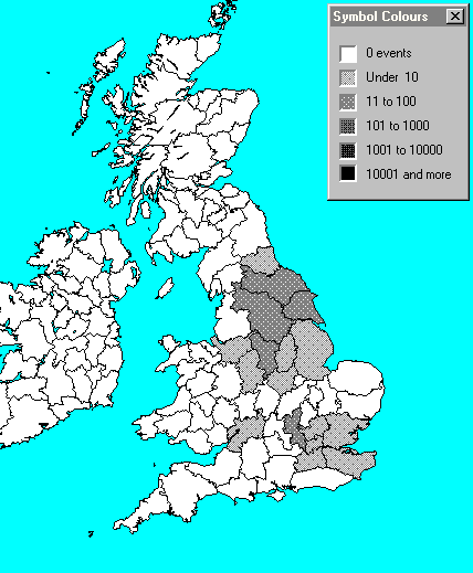
Pre 1600 Floodfill map - National
1600 - 1700 Floodfill map - National
1700 - 1800 Floodfill map - National
1800 - 1900 Floodfill map - National
1881 census Floodfill map - National
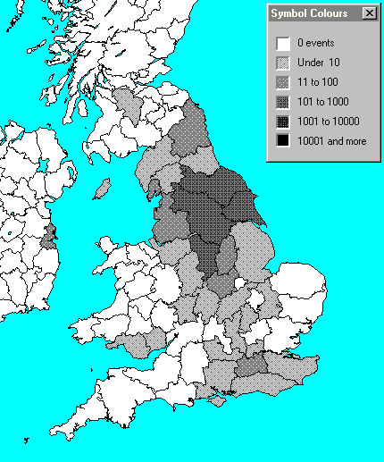
Jowett total distribution
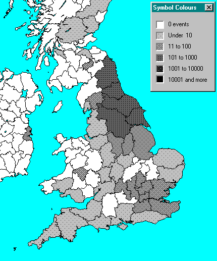
Jewitt total distribution
North America
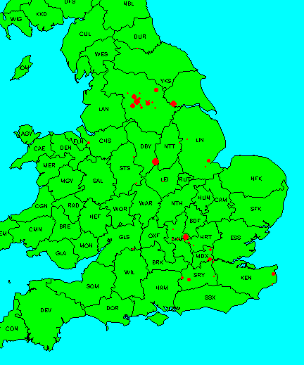
Map 1: IGI entries pre 1600
All variants, relative counts
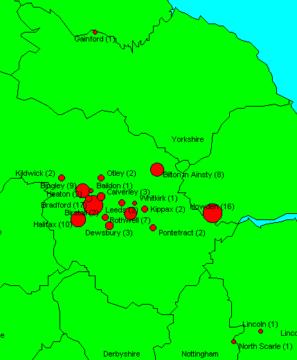
Map 2: IGI entries in Yorkshire pre 1600
All variants, total counts in brackets
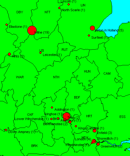
Map 3: IGI entries in Midlands and South East England pre 1600
All variants, total counts in brackets
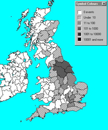
Map 4: Floodfill map, Jowett distribution 16th Century
IGI data, counts per million entries, all variants
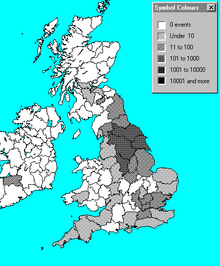
Map 5: Floodfill map, Jowett distribution 17th Century
IGI data, counts per million entries, all variants
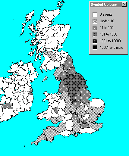
Map 6: Floodfill map, Jowett distribution 18th Century
IGI data, counts per million entries, all variants
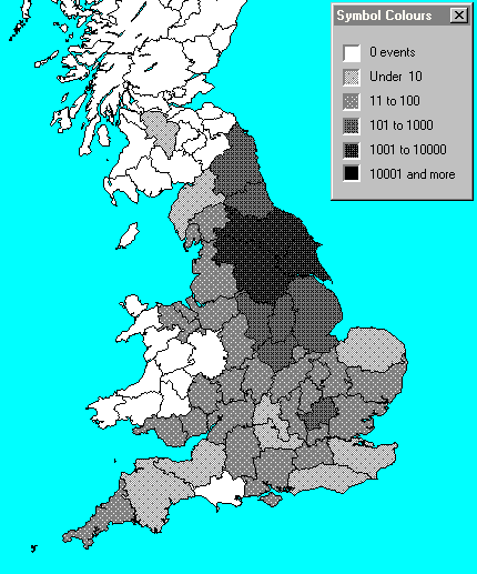
Map 7: Floodfill map, Jowett distribution 19th Century
IGI data, counts per million entries, all variants
Map 8: Floodfill map, Jowett distribution 1881 census
counts per million entries, all variants
Map 9: Floodfill map, all periods
IGI data, counts per million entries, J
o
wett variants only
Map 10: Floodfill map, all periods
IGI data, counts per million entries, J
e
witt variants only
Copyright S D Jowitt